Sunday 8 December 2013

#008 Navigation: tools for the 2014 Spine Race (Updated Feb 2014)

With the 2014 Spine Race just over 4 weeks away and Christmas in between, the focus of this weeks blog is selection, use and care of navigational tools, with specific emphasis on the Spine Race itself.

This, of course, is a subjective theme, as many racers will have their own tried, tested and proven systems. In this case it is best to stick with what you know to be successful.

However, from my own observations and experience in the Spine (Mountain) Safety Team, I know there will be Spiners out there who might be wondering which navigational tools will be best for the race, how they work and how to look after them.
In which case, this blog might offer some assistance.

MAPS

The recommended mapping for the Spine Race is the three 
Harvey 1:40,000 Scale Pennine Way series (South, Central & North).

There are several reasons why this is a good choice:


1) The Pennine Way 'corridor' is laid out as 'strips' on the map sheet, so only the area of travel needed is shown. 
This enables the route to fit onto just three map sheets.
Compare this with Ordnance Survey maps for which you would carry a lot of extra paper.

At 1:25,000 scale: OL1, OL21, OL2, OL30, OL19, OL31, OL43, OL42, OL16 (9 maps)

At 1:50,000 scale: 110, 109, 103, 98, 91,92, 86, 80,74
1:50,000 is a smaller scale than 1:40,000, so we can
readily rule this out.

There may be some merit using small sections of 1:25,000
in areas where navigation is perceived to be difficult, as the extra topographical detail (contours & rocky features etc) may be of help in more efficient route finding.

it is true some navigators do not get along with the Harvey maps. The scale takes a little getting used to (2.5 cm on map = 1km) as do the contour intervals of 15 metres, which when tired is not so easy to add up as the 10 metre contour intervals shown on OS maps.
To get over this: If you need to scale a short distance use the scale or romer on your compass base plate (we shall return to this later). If you need to find out how much ascent/descent there is on hilly ground, count the thicker 'register' contours which are at 75 metre intervals (eg 3 register contours x 75m = at least 225m, but not more than 300m).

2) Harvey maps concentrate on features readily identifiable to walkers, i.e. unlike Ordnance Survey maps, features not actually on the ground such as parish boundaries [which are sometimes confused with rights of way] are omitted.

3) The Harvey maps show the Pennine Way in red, this varies from dots to a solid line depending upon the ease of route following (i.e. dots = no visible path, solid line = road).

UPDATE Feb 2014, newly available mapping at 1:25 000 scale:
For those who prefer 1:25 000 scale, A to Z have recently published in booklet form Pennine Way, North & South. 
A to Z have used Ordnance Survey mapping, creating a corridor of 2 to 3 km either side of the Pennine Way. 
The booklets are 26cm x 24cm when opened, so are convenient for map cases, which you will need as one downside is that they are not waterproof!
Efficient positioning of the map 'corridor' means weight is not really an issue in comparison with the Harvey series.
Additionally, there is a useful route-planning section at the end of each booklet, indicating distances, locations of restaurants, cafes etc. Theres also a conventional index with places given a page & AtoZ style grid locator as well as a Ordnance Survey 6 figure grid reference.
With the arrival of the AtoZ option, there is a useful and practical choice of mapping available for Spine Racers.


COMPASS

Two questions arise here: One compass or two? And what features should I look for on a compass?

Starting with the the first: I always carry two compasses when navigating in the mountains.
The reason for this was learnt the hard way when I once lost my compass on a snowy winter mountain day in the Lake District (despite me thinking it was physically tied onto the chest zip of my salopettes). I had a GPS as backup, but the problem with this was that you need to be actually moving for the GPS compass function to work properly. I wanted to stand still and plot my direction of travel but my equipment was forcing me to move in order to obtain a bearing. 
That day I fully appreciated how important is the ability to: Stop Think Orientate & Plan.

Ok so next, what type of compass?
Navigation on the Pennine Way varies from easily following signs to complete absence of path in places. Add to this a covering of snow and you are into challenging expedition route finding.
Hence, I would go for a small, lightweight, orienteering style/thumb compass for the straightforwards journeying sections.


For the more challenging stuff, I would switch to using a conventional walkers compass.
I find the Silva Expedition 4 a particularly good and versatile choice, it has:
A baseplate large enough for easier use when wearing gloves.
Smooth moving and fast settling direction needle.
Fluorescent markings for night navigation.
Romer scales for 1:40,000 1:50,000 & 1:25,000 maps. 
(Romers take all the work and estimation out of giving a 6 Figure Grid Reference. They are also very useful for directly scaling short distances on the map without the need for conversion.) 


There are lots of other compasses out there and I'm not sponsored by Silva, so there's no vested interest in my suggestions.
Note: Before you go and buy an Expedition 4 you need to be sure of two things:
1) It is the civilian version (i.e. 0 - 360 degrees on the compass bezel, not MILs)
2) It is the modern version with 1:40,000 romer. The old version has 1:63360 inches scale.

COMPASS CARE

I often hear and read comments such as "this/that compass is rubbish" (or substitute more colourful language in the appropriate place). However, before blaming poor quality manufacturing, we must also look at how the compass has been used and stored. For example:

1) Has the compass been stored next to another magnetic source. It doesn't take a stack of guitar hero Marshall speakers to ruin the magnetism or polarity of a compass. 
The speakers in the footwell of your car also have adequate potential to do this. 
Reversal of needle polarity (so that south points north & north points south) could also result.

2) Similarly, if you try to use the compass whilst under electricity pylons, this might affect accuracy. In fact other electrical devices such as mobile phones or your GPS could do the same if too close to the compass (eg in the chest pocket).

3) Metal bracelets, metal belt buckles and metal underwired bra's have could influence the compass needle (I have not tried the last one!). So when using the compass, hold it away from your body.

4) Less frequently seen, a compass needle which does not 'settle' might be affected by magnetism of underlying rocks. Although more likely is that the needle has become de-magnitised so some extent. The compass needle is a magnet and magnets do not like being dropped or banged about (memories of secondary school science lessons here).

I have a fabric sleeve which slips over my compass when I'm not using it. This also helps prevent the base plate becoming scratched and opaque. 

4) It helps to think of the compass as a precision instrument which will reward the user with accuracy and longevity. But if your compass is the same one you had when you did your bronze DofE award with the scouts, then it might be time to retire the old workhorse and buy a new one.

WRISTWATCH

A wristwatch should also be included in your navigational tools. Estimating the time for a navigation leg is an important factor in determining your progress along that leg, or indeed whether you have gone too far.

Your watch doesn't need to be anything flash...like one of those nice (but expensive) Suunto's.
It just needs to be reliable, waterproof and have numbers or hands which light up. This last feature is desirable so that during fading dusky evenings or moonlit nights you don't need to ruin your night vision by switching on the head torch before you need to (for this reason ex-military guys are very keen on head torches which also have a red-light function).

GPS

GPS is on the Spine Race compulsary kit list. The times I find a GPS most useful is for quick position relocation using the grid reference screen. Mostly my GPS is switched off and kept in the top of my rucksack.

For me, by using a map and compass I am observing and connecting with the environment, which enhances my enjoyment of journeying. Simply following a GPS tracklog would distance me from this experience and lessen my pleasure in being outdoors.

But following a tracklog at night or white out, with no actual path or other visual reference features is not an efficient strategy. There are varying position triangulation inaccuracies depending upon satellite availability and overhead tree canopy. Also consider what the the actual tracklog on the GPS screen represents in real life...it could be 50 metres wide or more!
Therefore to register off-track the actual route taken can and does weave from side to side, thus wasting time and energy. 

But don't just take my word for it, here's a tracklog following error experienced by a Spiner on a recent reccie...


Hence, my GPS unit is one of the most basic and inexpensive. It is the older version of a Garmin E-trex10. At the other end of the scale it is possible to spend a small fortune on the latest units and mapping packages. 

A budget compromise might be to consider the Garmin E-trex 20
It is essentially similar to the basic model, but with the additional option to download maps (at extra cost) and a colour screen.

GPS CARE

For Spine Race conditions I would seriously recommend additional waterproofing, no matter what the manufacturers claims are in this regard. In the 2013 Spine several GPS units completely failed due to water and condensation ingress, at times and in circumstances when they were most needed!

There are some good transparent weather proof bags available inside which mobile phones and GPS units can be both stored and used. It would not hurt to also add a sachet of silica gel to soak up condensation build up within the bag...as the unit will be transferred from cold/cold &wet outdoor conditions to warm indoors and back outside again, several times during the race.
On Friday 10th January in the comfort of the Castleton Youth Hostel we shall be offering our 2014 Spine 'Complete Racer Masterclass'. 

The 2013 masterclass was very successful, with all participants either finishing, or implementing techniques learnt to progress to advanced stages of The Spine.

Starting at 12:30 until 16:00 (meeting from 12:00 onwards) the 2014 session will be a relaxed afternoon indoors with a mix of presentations, demonstrations, Q&A opportunities and informal discussions over coffee/tea. Our aim is to help racers implement energy saving techniques and efficient strategies across the whole racing skills set. We also include a last minute brush up on navigation with course specific examples.

In summary, enabling Spiners to race further & faster.

Drinks and biscuits refreshments will also be served.
Numbers are limited, to book your place (£30 per participant) please contact:
Stu Westfield    Mobile: 07890 620274   Email: rangerexped@hotmail.co.uk


Tuesday 19 November 2013

#007 Bushcraft - Journeys Into The Stone Age

Anyone interested in the subject of bushcraft soon realises that the trail of knowledge originates with our earliest ancestors in the stone age.
 
Many of the skills we now use to journey through the countryside, hills and mountains can be attributed to bushcraft. From the quick weather check before departure, to an awareness of the nature we see along the way and the camp craft we use as the sun sets. 


Although today we might use the terms hill skills or mountain craft, all in one way or another are an extension of bushcraft techniques that have developed through the ages of time.


Oxygen isotope analysis shows that the bronze age Amesbury Archer, who's grave near Stonehenge was dated to 2300BC, originated in the alpine region of what is now France.
In those times his journey to Britain would have taken months, if not years. We will never know whether he was making a pilgrimage to the stones, seeking a cure for his diseased knee cap.
Or, he may have been the bearer of secret knowledge regarding the metallurgy of making bronze from tin and copper. Whatever the reason, the journeying (or bushcraft) skills he used along the way would have been of everyday second nature to him.
 
In Britain there are the faintest smudges of evidence remaining from the Mesolithic, or middle stone age. Charred hazlenuts, carbon dated to a time just after the last ice age and flint worked into arrow heads and hand axes, give us the briefest glimpses into a way of life that still tenuously exists in just a few places on earth: The Hazda in East Africa, for example.
 
By comparison, the new stone age, or Neolithic, represents a seismic change, a revolution in human culture which has left us magnificent megalithic constructions of stone circles and tombs in the landscape.
 
I am fascinated by this period of change. How did the hunters react to the new stone age farmers? In some places it may have been a peaceable process of integration, exchange of meat for useful items like pottery for instance. Whilst in others there might have been extreme violence. The hunters shocked, distraught and angered at the destruction of the wild forest.
 
The hunters surely viewed themselves as being part of the wild forest that covered much of Britain at that time. By contrast the ways of the farmers, felling the trees and tilling the land for crops were ultimately incompatible.
 
In the tombs and monuments that the Neolithic farmers created there remained a strong reverence for nature and ancestor worship, but this became ritualised with increasing complexity and statements of construction, in what might be seen as a prototype of religion at the beginnings of human society.
 
I have traveled from the northern Isles to the most southerly Islands of Britain in a quest to further understand this incredible period of change. From this will emerge three films.
 
The first is "A journey through Neolithic Orkney", which was published in two parts on You Tube earlier this year.

PART 1...
PART 2...


The second is "The neolithic revolution in ancient Guernsey" which I have just completed and released.


The final part is set on the island of Mull and through a investigative process pieces together clues from geology and living nature to show an environment where Mesolithic hunter gatherers would have thrived. And a neolithic culture of cosmology which continued into the bronze age.


Just for fun, we even made up a box set....(not available in shops, but all the films and more can be seen at the Ranger Expeditions channel on You Tube).


Wednesday 28 August 2013

#006 Bagamoyo Blues

Experienced African expedition specialist Stu Westfield offers a uncompromising, unflinching and potentially controversial view of life and the winds of change in a small town on Tanzania's Indian Ocean coast.


BAGAMOYO
TANZANIA
EAST AFRICA


Ten a.m and the streets are still and deserted, save for the odd boda boda forlornly scouting for a fare. Rustic mud brick houses, slowly falling back into the alluvium sand from which they were made, regularly punctuate those still in habitation. Trees and bushes now growing through empty windows, an age gone since human eyes looked out of the gloomy interiors.

Hand painted signs advertise the Poa Poa Restaurant; food at 'cool cool' prices. Dusty side streets and blind alleys lead to single room homes, just off the rough main thoroughfare where artisans ply colourful naïve oil paintings of Masai, giraffe and the odd pastiche of Livingstone himself.

Its a sleepy backwater surrounded by mosquito infested papyrus swamp on the inland side and golden sand beach on the other. The quiet rhythm of life having ebbed and flowed like the tide since Livingstone, then Stanley, stepped ashore nearly 150 years ago. Starting one of the greatest search and rescue stories that can be told. The sign above the entrance on one building boldly declares in yellow paint that 'David Livingstone passed through this doorway'.


Livingstone stands high amongst pioneering explorers from the Golden Age of Discovery. But as a Christian missionary he was spectacularly unsuccessful, with only one lasting convert. Although perhaps this is unimportant, given his ultimate legacy. He became such a thorn in the consciousness of the slave trade he despised, that he is ultimately accredited for initiating the movement to end the devastating traffic in African lives.

But, within the slumber of Bagamoyo is an undercurrent of anticipation. As if awaiting the resurrection of Livingstone to bring the promise of progression, like the great missionary himself once did. Maybe Bagamoyo's rise to salvation will be the coming of the tarmac artery linking a new port to major towns to the west and Dar in the south. European and Chinese investors have spied lucrative profits to be snatched from under the noses of the unwary with the collusion of the corrupt, while the World Bank cannot part with its money quickly enough in their belief that African's are incapable of helping themselves.

Then there's the ubiquitous presence of NGOs, all with promises of doing 'good work', but in reality enshrining a dependency culture from which Africans will be lucky to ever escape. In Uganda, I was frequently accosted by children with outstretched grasping hands, already conditioned to demand with a precocious sense of entitlement "Where is my money. Give me my money!".

Is this the new slavery, under the guise of 'worthy deeds'? Our perception of material inequality wrestled away with conscience salving direct debits by giving "Just £3 per month"...to the poor helpless African..."to provide urgently needed"...fill in the blank. Cut to a close up of a child's face with wide innocent eyes, tear stained cheeks and flies feeding on the pap in the corner of its mouth. Every day NGOs pay huge sums of money for these images to cover our television screens, chiding us into guilt, to pay money, so that they can drive white £44,000 Toyota Landcruisers around the continent at eighteen miles per gallon.

Surely it is trade without exploitation, if such a thing exists, is what African governments should insist upon, on behalf of the people that elected them. Not the rape of its resources with aid drip fed from NGOs in return.

But has Bagamoyo really got it so wrong, whilst the developed world rushes headlong into a modernity where we spend our hard won remuneration on plastic tat that makes us feel transiently better about ourselves and our own predicament of bonded labour to a glass screen and qwerty keyboard?


With the exception of the odd tourist hotel with thatched bandas, under which a chilled soda or evocatively labelled Serengeti beer can be sipped in the shade, the last 150 years on Bagamoyo beach have changed little. Dhows with white raked back sails still skim the horizon under a blue sky punctuated by clouds promising rain but rarely delivering more than a few drops. Palm trees overhead rustle in the breeze which picks up with the incoming of the tide early this afternoon.

'Mister Cheapy Cheapy' obscures my turquoise view while he tries to entice me to buy a wooden carving of a rhino or a bead bracelet at 'good price'. Later, a man in ragged trousers carrying a sorry looking sand covered fish swaggers up to me. I cannot decipher the Kiswahili from his treacly bass voice save for the words safi samaki, fresh fish. I counter with a hapana asante, no thank you, and he moves on.

Other beach peddlers pass by. The freshly cut coconuts on offer seem a little better bet than the dubiously chilled ice cream from a box on a tricycle with an ineffective umbrella on top. Mostly I'm left in peace, nestled into the cool silica grains under the shade of my palm tree. I'm invisible to the few other wazungu uneasily strolling barefoot on the soft white sand. Frequent glances back to the safety of their hotel exposes a straight-off-the-plane insecurity which ties them with invisible shackles. I can't help but think that trousers which end at calf-level are never a good look, no matter how exotic the location.


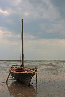
Fishermen land a meagre catch from rustic boats and dug-out canoes with outriggers bob towards the shore. Some of them look seaworthy. A subsistence living, yes possibly, but one which has endured the rise and fall of sultanates and empires.

Some of the fish are descaled and gutted on the beach just outside the fish market. At the end of the afternoon the sand glistens with pearlescent flecks and a pungent smell clears the nostrils before the tide once again cleanses the beach. Two white collar ravens caw above the palm fronds and egrets fly overhead. The sea, a giver of food in all states of life and decay.


A young woman sits down and leans wearily against the next palm tree. I saw her earlier, asleep on the sand, face covered with her green kanga stretched over her head. I think she has probably been here all night. She looks tired and hungry.

More dhows are now weighing anchor and further down the beach is busy with locals. I stand up and dust off my khakis. I love the heat of the African sun but hold no enthusiasm for toasting myself to lobster colour in a basing of cancer protecting white gloup.

Without drawing attention, I offer my uneaten fruit to the young woman as I walk past, with a few words of broken Kiswahili which I hope conveys respect. She takes the food with a cupped had, expression unchanged. I walk down the beach wondering, in light of my cynicism about NGOs, if I have just been a hypocrite.

I step over and under several mooring lines tying the nearest dhows to thick palm trunks growing high on the beach. Chippy chatter of bartering and deals being struck now fills the air, mixing with the odours of a working fish market. I turn inland and the sand is now a greasy grey consistency, coagulated by centuries of raw fish oil. Under rows of rough hewn timber roofs the serious business of fish processing goes on.

Over fiercely burning charcoal fires the catch is vigorously fried in great bowl shaped pans, the fat bubbling, spitting and popping. It seems to be a culinary insult to fresh fish, but much of it needs to be preserved for it will travel inland to the markets of Moshi and Arusha.

At the end of the market is a handful of stalls with domestic products for sale. From a mosque which also advertises itself as a hostel, call to prayer warbles from a minaret. Any tune is killed by the poorly amplified speakers. These mu'addins just ain't what they used to be. A few hundred metres away a prominent cross of the competition silently intrudes on visitors to the other end of the beach.

I carry on with unbroken stride, back through the juxtaposed dilapidated and newer block built homes. I find the Poa Poa Restaurant and sit down to what turns out to be a good but appropriately mis-spelt cafe late.

After a few sips, I wonder how long Bagamoyo will continue to wait until the late Livingstone's second salvation. Another saviour which Bagamoyo neither wants, needs, or asks for.


Friday 5 July 2013

#005 A Bushcraft Journey

Over recent years bushcraft has grown in the nation’s consciousness and has devotees from the armchair enthusiast to iconic educators who are masters of their craft. The historical record shows that there have always been bushcrafters, they were just called different names: woodland managers, mountain men, voyageurs and of course the original paleolithic hunter gatherers. But when and where did the new bushcraft resurgence and insatiable hunger for outdoor living skills originate?


In the 1980’s the developed world was cruising headlong into the computer age, living by mantra’s such as ‘lunch is for wimps’ while the corporate ladder offered the promise of untold riches and promotional carrot ‘if you stay on after work to complete this report for me’. In our oil driven economies the prospect of the black gold riches drying up was too far off to really worry about, habitat destruction was a problem limited to the Amazon basin and the reality of climate change was still mainly academic.


Into this crashed Paul Hogan starring as the larger than life character Crocodile Dundee. Amongst the outrageous plot lines were some gems of the subject we now know as bushcraft. Who could forget the scene where Mick Dundee calls on his aboriginal friends for help using the ‘bush telegraph’ (an item properly known as a bull roarer). Or, when he introduces his girlfriend to the wilderness known as Belongamick (Mick’s Place). The film also introduced us, albeit with clumsy Hollywood simplicity, to the idea of respect for first nations people and their knowledge.

In Britain, it wasn’t until Ray Mears first appeared on our TV screens that bushcraft came of age. His down to earth enthusiasm, kinship with the last remaining hunter gatherers (that episode with the Hadza still gets me every time) and deep respect for ‘the nature’ was infectious.
My bushcraft journey had begun.

For my Mountain Leader (ML) assessment I invested a lot of time into researching the subject of re-wilding for a presentation and producing laminated crib cards of upland plants. One of the assessors liked them so much, he used copies to help with his revision for the International Mountain Leader (IML) award.
When journeying, I began to introduce elements of bushcraft such as experimenting with baking bannock and stockman’s bread on an open fire. On my navigation courses I discussed where to look for natural clues which would complement conventional map and compass skills. Each time expeditions took me back to my beloved East Africa, I made time to learn something new: animal behaviour, ecosystem issues or a few extra words of Swahili.

 
A thirst for more in-depth bushcraft knowledge and the ability to practice these skills with greater proficiency led me to sign up with the Woodcraft School on their advanced course. The course is unique in that it is accredited by the Institute of Outdoor Learning. It is divided into a five day teaching block, followed by a three week period for self-study and practice, then concludes with three days of assessment (although guided learning carries on right through the whole process). 
 
The Woodcraft School is situated in a private ancient woodland in the South Downs National Park. It is run by John Rhyder, a foremost expert in forest management and bushcraft skills. He is assisted by instructors who have graduated through the Woodcraft School year long diploma course, all highly skilled and able to share knowledge in their own personal style.
The course began with safe use of the mora knife, the most commonly used bushcraft tool, developing the range of cuts over the week from shaping simple log splitting wedges through to carving items such as spoons and bowls.

Then there was fire by friction, for many of the students the holy grail of bushcraft. We used the bow drill method. What came as a surprise to me was the amount of fettling and tweaking needed, combined with good technique needed to turn wood into hot black powder, accumulating enough for it to glow as a dull red ember. Then there was the delicate transfer of this hard won coal into a straw bundle, followed by long gentle breaths and wafting, patiently coaxing the smoke into flame. It took me several attempts, but the satisfaction of eventually seeing the dancing lumiere at the ends of my fingers felt like alchemy.
 
The foundation of bushcraft is knowledge of the natural world. On a woodland walk, John showed us plant and tree species, taking time to discuss their multitude of uses: bark for tinder, bow drill materials, medicinal remedies and good eating. Pendulous sedge seeds bound together with egg white and dry fried was surprisingly tasty, as was burdock root roasted in fire embers. Importantly, we also learnt plants with toxic effects.
Like with our paleolithic ancestors, bushcraft knowledge is carried in the mind, meaning craft skills are essential. I wanted to produce something personal to me, it could only be one thing, the bull roarer. I split down a piece of western red cedar. Shaping the shingle into an oval and tapering the cross section into an aerofoil. Sanding brought out the lovely wide grain of the wood, but it was blank, it needed a something extra. The story I etched into my bullroarer was inspired by San bushmen cave paintings I had seen in Namibia. I also wanted to express the sense of connection the hunters had with the land, a connection which stretches back to the unwritten sub-conscious memory of the Mesolithic. I attached a long length of three-ply cord, twisted it up and spun the bull roarer, whipping it round to make it whirr and sing in oscillations.


Returning three weeks later, I felt a certain amount of nerves. It had been a good few years since I had sat any form of written exam. John and his team reviewed every subject the day before each assessment. I found it really helped to be in the context of the woodland. At one point I chatted with John about the assessments and we both agreed they are not designed to be stressful provided the candidate has spent time to practice and revise during the consolidation period. If no additional work had been done it would be a struggle.

 
Results were given soon after each test and my confidence grew once I had successfully negotiated the trees, plants and their uses with maximum points. Thankfully, I made fire by friction at the first attempt and my other fire making methods (solar reflector, fire steel and chemical reaction) all worked well. The water safety, hypothermia and hyperthermia papers were all easier for me with my background in expeditioning and mountain leadership.

Finally there came the tracking test. This had become a favourite subject. I sensed the spirituality in following sign and telling the story of the animal which left it. John had marked various sign on a trail with a series of flags. We had to identify the animal which left the sign and explain why it was there. Apart from a minor wobble where I managed to convince myself that rabbit was actually muntjac (eh, a lop eared furry deer…I know!) I got through the pass mark of 80%.
All too soon it was time to break camp. It had been an excellent course, characterised by laughter with fellow bushcrafters and the sharing of knowledge which had true value.


I’m now looking forwards to incorporating more bushcraft activities into Ranger Expeditions courses, enabling clients to enjoy a deeper understanding of the environment in which they are journeying and maybe sense the traditions of those mesolithic hunter gatherers who have gone before.
What’s great about bushcraft is that there is always more amazing things to see, skills to learn and experiences to enhance understanding. In many ways the journey has just begun.


Friday 22 February 2013

#004 Super Slow Motion

An now, to quote Monty Python, for something completely different:

A couple of years ago I attended a Wildlife Camera Operator course run by the Wildeye Film School.
On this particular course, one of the instructors (Jonathan 'Jip' Jones - BBC Life In The Undergrowth, Swarm, Nat Geo Great Migrations) brought the new Photron SA1 high speed camera for us to use (under supervision). At the time there were only about three of these £100,000 cameras in existence and just this one was in the UK.

For such an expensive piece of kit, one might have been a little underwhelmed by its appearance. It was a aluminium box with heat dissipating fins on the sides, military style aerospace connectors on the back and a standard lens mount on the front (lens not included in the price).


But the magic lay with the technology and processing power within the unit. Modern cameras of this type can capture events such as the shock wave ripple in air following an explosion and slow the action down so that we can view it.

The other great feature is that it continually records and overwrites data so that if the operator is waiting for an event to occur (eg wildlife cameraman Simon King filming great white sharks 'torpedoing' seals off the coast of South Africa) the save 'record' button is pressed after the action has taken place and the sequence is then stored on hard drive memory. This is something that would have been prohibitively expensive in the days when film stock was needed for recording broadcast quality slow motion footage.

On the course we set up various scenes with jumping frogs and the simplicity of popping water ballons demonstrated the camera's capabilities very well.

Until that is, I somehow became the 'volunteer' stuntman for live water ballon experimentation!!!
The results speak for themselves. Stay with it for the 'out takes' at the end!


Link to You Tube:
http://www.youtube.com/watch?v=2Cejq-V3R-8

Footnote: The Wildeye International Wildlife Film School runs a variety of courses from film research, sound recording and camera work, through to the editing and production process. These highly enjoyable courses give access to information and practical skills which are difficult to acquire elsewhere, making them a fast track to producing your own quality films.
http://www.wildeye.co.uk/


Saturday 16 February 2013

#003 Rwenzori - Mountains Of The Moon

For this week's blog, I invite you to accompany me on a journey to a mountain wilderness of strange plants, endless bogs and equatorial glaciers. Known today as the Rwenzoris and named in antiquity as The Mountains Of The Moon, it is a land of intriguing wonder and fabled legend.

On the western edge of Uganda, bordering the Democratic Republic Of Congo, the saturated jungle scenery for our expedition could have been lifted from the pages of Jospeh Conrad's claustrophobic sojourn into The Heart Of Darkness. However, we took our inspiration from the trail blazing explorers of the Victorian and Edwardian times, literally treading in the foosteps of giants from the golden age of discovery.

As with my last blog, it is a timely posting, as the Rwenzoris featured in the recent BBC documentary 'Africa'. The film shown here was shot on handy cam by expedition member Bruno Baschung. It was originally intended as a personal memoir of the trip. However, when Bruno mentioned he did not have editing software, I offered to take the clips and see what I could do.

The result here is a 2 part mini-feature. So, fire up the JetBoil, fasten your boot laces and enjoy the adventure.

PART 1 (link to You Tube)
http://www.youtube.com/watch?v=mAPgB6Fslrc

PART 2 (link to You Tube)
http://www.youtube.com/watch?v=Z3jgzY-6He4

P.S. Since this film was produced in 2007, there is another excellent option now available starting from Kilembe and run by John Hunwick.   http://www.rwenzoritrekking.com/


Saturday 9 February 2013

#002 Lion Tracking In Lewa Downs

From the first time, as a young boy, I watched a David Attenborough film of Cheetah chasing Thompson's gazelle in the Serengeti, Africa has captivated my imagination. Several years later I was lucky enough to make my dreams come true on a Tanzanian safari.

At the time, I thought this would be a once-in-a-lifetime trip, after all safari is not cheap and it took quite a bit of saving up. But as the aircraft turbines roared over Kilimanjaro on the homeward bound flight, I realised a had left a little of my heart swirling in the red dust of East Africa. I knew, somehow, someday, I would...I must, return.

Fast forwards to now; as a Mountain & Expediton Leader and I have lead several expeditions to east and southern Africa, journeyed through wilderness of jaw dropping beauty, climbed amazing peaks and observed wildlife in many game reserves and national parks.

My passion for these special places still burns just as strong as the first time I stood on the edge of Ngorongoro Crater and saw the vision of a real life Eden before me. Many of my friends know of my enthusiasm for the subject, especially when oiled with a single malt (preferably Talisker).

So, with the imminent danger of boring them with another story, I'll share this one with you from 2008. It is very topical as Lewa featured prominently in BBC documentary 'Africa' (with the wonderful David Attenborough) and also included 'Elvis' the black rhino.

LION TRACKING IN LEWA DOWNS

I braced myself as our Landcruiser rattled along the serrated track.  Its wheels alternately cutting into the dark volcanic sand then bouncing over consolidated gravel.  A cold draught blew over the plain and gusted through the open sided vehicle.  Shivering, I shrunk deeper into my fleece jacket.

Back in camp, everyone else had forgone the early wake up call and remained tucked under their warm blankets.  Their reticence was entirely forgivable as most of us had competed in the Safaricom marathon the previous day.  It is the only event of its kind held inside a game reserve and this year the start had been delayed by fifteen minutes while rangers ushered a lion away from the course.

During the race, the cool morning was quickly replaced by temperatures so hot that the very air felt like it was on fire.  My early speed was slowly ground down until I was running in battle of attrition.  The Kenyans, naturally, were all miles ahead.  Some had already completed the course in a little over two hours.  For the final six miles I had mostly run alone, a solitary figure in a wilderness paradise.  My legs were shredded, but pride gave me the motivation to turn on the gas, allowing me to claim the distinction of the seventh non-Kenyan to cross the finish line.
 
 
I had run the marathon to raise funds for Tusk Trust, a charity which, for the past twenty years, has instigated a quiet revolution in conservation practice.  Tusk’s key thinking is that to achieve effective conservation of wildlife and habitat, one must recruit the support of communities and invest in education.

In partnership with Tusk, the Lewa Wildlife Conservancy and its outreach programmes have dramatically reduced poaching in a vast area of Northern Kenya.   Rhino numbers have been given a chance to recover and elephant can once again follow their ancient migration routes.  Lewa is also a refuge to the critically endangered Grevy’s zebra.
 
 
This was the final morning before returning home and I didn’t want to miss any opportunity to see more wildlife.  Above, a myriad of constellations were ushered away by the first rays of dawn and a warm pink alpenglow touched the frost shattered pinnacles of the mountain guarding the southern horizon.


We approached a white rhino with calf only a few weeks old, gambolling ahead of it’s mother.  William cut the engine, allowing me to capture a few frames in the glorious light conditions.  The only sound was a gentle rustling of tinder dry straw grass serenaded by the cool breeze.  A Pangani Longclaw, conspicuous by its bright orange throat plumage, perched on a nearby branch of whistling thorn.  His speckled chest feathers gently ruffled to retain heat.
 
 
The radio cracked into life and William held a brief discussion.  He then turned around to face me.

“Would you like to track some lion?”  he asked.  “There is a ranger not far from here.”

“Yes, absolutely,”  I answered with enthusiasm.

Equipped with radio receiver casually slung by a leather strap over one shoulder and large calibre rifle, just in case, the ranger was waiting patiently for us beside the track, as if time had no relevance.  He wore the khaki uniform of the wildlife conservancy but his tall proud stature and ear lobes stretched into hoops belied his Samburu roots.  He introduced himself as Nyekundu.

“Why ‘red’?”  I asked.

“I was named after a red cow,”  he replied in all seriousness.  Just like the Masai, cattle form an integral part of Samburu culture, indicating wealth and status.

Soon he spotted a clear set of cat prints leading towards a nearby hill.  But, while traversing over the broken, rocky ground we lost them.  So, William drove us to the top where the views were unencumbered with vegetation.  Still finding no sign in the immediate vicinity, Nyekundu switched on the receiver box and held up his aerial.  It looked much like one used with a small television.  An audible blip interrupted the static on his receiver box indicating the direction of our lion. 
 
 
We remounted the Landcruiser and headed down onto the rolling plains.  In the lee of the hill, the air was still and hot now that the sun had arced higher into the cobalt blue sky.  I removed my jacket and rolled up my shirt sleeves.  Periodically, Nyekundu stood on the footplate checking his ‘blips’ and from their gestures I guessed he and William were debating the best line of approach. 

There was an abundance of game in the valley where Grevy’s zebra, giraffe and waterbuck all grazed on last of the lush grass, awaiting the return of long rains.  We stopped again but this time I could hear that the signal was weaker. 

“Hold on,”  William said, as he turned the vehicle around and slowly steered across rough scrub towards a thicket of fever trees.  We appeared to be travelling around the perimeter of a near impenetrable mass of vegetation, tangled with thorny acacia.  The aerial was held aloft and we were rewarded by a loud ‘blip’.

“The lion is in that bush,”  Nyekundu quietly informed me.

I strained my eyes but could see only leaves.  William drove around to the opposite side.  Still nothing.  But then as my vision adjusted from the bright sunlight to the recesses of the bush, I saw a brief shake of twigs.  It was a cub!  Then I saw the lobe of a large fawn coloured ear and an unblinking amber eye burned through the shade.  The cat wearing the radio transmitter was a lioness.  She was laying on her belly with huge cupped paws stretched forwards.  We had found her and her young litter, in a place where she would be untroubled by other game during the heat of the day and out of sight of most humans. 

We all sat contentedly watching the cubs play.  Photography was pointless, the lair was too well obscured for any shots to be worthwhile. This did not matter.  The enjoyment was in seeing the results of Nyekundu and Williams’ field craft.  They had combined traditional tracking skills with contemporary technology in a way that was both immeasurably enjoyable and informative. 

William was back on the radio.  “The camp manager is worried you’ll miss breakfast.”

“Let’s stay for just a few more minutes,”  I grinned.  “I can do breakfast any day of the week.”
 
 
Footnote: Sadly, since originally writing this piece in 2008; across the continent Rhino are once again under unprecedented threat from poaching, with an average loss of one rhino per day. A statistic which I find utterly shattering. If you are able, please give what support you can, even if it is to spread the word, about the essential work done by Tusk Trust in ensuring that Africa's wildlife is still here for all our tomorrows.