Friday, 13 May 2022

#063 In search of the stone age - Ancient Arran

Evidence of human activity on the Isle of Arran dates back to the Mesolithic (middle stone age). These people were hunter gatherers who would have taken advantage of the heavily wooded lowland areas for fuel, shelter materials and fruits of the forest. On an island where the sea is never far away, the foreshore offers abundant foraging opportunities. Fresh water rivers and streams consistently flow from the central mountains, lochs and lochans. Roaming in the forest and uplands, red deer were a ready source of protein which could feed a whole extended family.

Credit: Kim Biddulph - Prehistory blog

Before we get too much further into dates and detail, it's worth at this point adding a timeline encompassing the Mesolithic, to Neolithic, to the metal ages, in ancient Britain. I emphasise our British geographic locality, as the dates of the Neolithic and bronze age transitions vary. These new ideas and cultures did not arise everywhere spontaneously, they spread through migration. Both in people's minds and portable trading goods. So, for example, the Chalcolithic (pre-Bronze copper period) was present in Europe around 5000BC, but would not arrive in Britain until 2400BC in the form of daggers and axes.

View to the west from Machrie Moor

Hunter gatherers are typically mobile, moving between temporary or seasonal camps. This has the advantage of following game migrations, sources of edible plants and fruiting berries. Relocation tends to avoid overexploitation of resources and periodically refreshing dwelling structure materials reduces the insect burden.

Standing stone, with possible cist at rear

The Machrie is surrounded by an arc of high ground and fed by freshwater, which drains into the sea on Arran's west coast. It is somewhat of a stretch to call it a natural amphitheater, but on first impression its geography did remind me of Lochbuie on the Isle Of Mull, which has all these features in common. Like Lochbuie, there are also caves. Nearby to Machirie is Kings Cave which no doubt was a feature of Mesolithic life.

However, a 1909 archeological dig found little of note except, an obviously much later, small bronze ornament and a few animal bones. Given that archaeological practice and methods have moved on considerably since the 1900's I wonder what subtle evidence of the Mesolithic might have been there, that is now lost.

Around 3500BC the Neolithic, new stone age, arrived in Arran. The spread of farming ideas, methods and culture from the middle-East, through Iberia and Gaul then into Britain was not simply a uniform radiation, like ripples on a pond. It vectored along corridors. Based on dating and typography of both portable and monumental evidence, Professor Alison Sheridan, proposes that there were four phases to the Neolithic 'revolution' in Britain:

1) First early, but unsuccessful, migration from Brittany to Ferriter's Cove in Ireland
2) Second, more successful, from Brittany up the Atlantic facade of Britain and Ireland in 4300 and 4000BC
3) The 'Carinated Bowl Neolithic' from the near continent, between 4100 and 3800BC
4) The Trans Manche Ouest strand from around 3800BC from Normandy, to The Channel Islands, The Bristol Channel and the south coast.

Current evidence suggest that it was people arriving with Carinated Bowl Neolithic culture which displaced or outcompeted the Arran hunter gatherers.

Machrie Moor 11 - on site of previous timber circle

Around 4500 years ago timber circles were erected on Machrie moor. This type of structure is contemporary with other locations in Britain, such as Wood Henge on Salisbury Plain. However, eight excavated post holes on the site of the current Stonehenge car park have been dated to 8000BC; firmly within this Mesolithic period. A possible indicator of ritualised behaviour involving astronomical interpretation being practiced before the arrival of Neolithic farmers. 

Machrie Moor 1 - on site of previous timber circle

Even using only a rudimentary phenomenology approach to the Machrie moor environment, it feels like a special place. It is the locus of natural features, mountains, rivers and sea. More than just a collection of the practical and useful, Machrie has an aesthetic quality that invites the visitor to stay. Perhaps our stone age ancestors, in deciding where to settle, felt a similar connection.

Machrie Moor 4

Five hundred years after the wooden circles were created, two stone circles were created on the same sites. Probably around the same time, four other stone circles were erected, one with a double ring of stones - known through local folklore as Fingal's Cauldron Seat.

Fingal's Cauldron Seat

The result was an impressive ceremonial centre for those that lived or travelled to Machrie Moor. Several of the stones appear to have been carefully chosen. Certainly the tall sandstone uprights bear a striking resemblance to the Orcadian Stones of Stenness in the way they have been cleaved from the bedrock. Burials within stone circles have been dated to within one or two generations after their creation. 

Machrie Moor 2

The Neolithic and later Bronze age farmers built their dwelling round houses (and there were many of them) in the Machrie moor area. Their locations are still subtly visible as slightly raised 'hut circles'. In 2018 the Norwegian Section For Earth Observation and Historic Environment Scotland published the results of a joint study of Machrie Mor using LiDAR (Light Detection And Ranging) imaging.

Machrie Moor LiDAR features: Roundhouses (cyan), small cairns (yellow)

The LiDAR technique highlighted even more hut circles and a nearby Neolithic cursus feature which had not been previously identified due to later bronze and iron age dwelling structures being built on top.
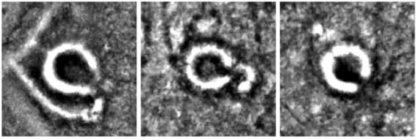
Machrie Moor: LiDAR roundhouse detail

I conducted my own desktop analysis using hut circles and other features on Ordnance Survey (subscription) mapping. I plotted these on a screen grab from Google Earth to show the distribution and abundance of these features: 


Cyan = hut circles
Yellow = cairns, cists and burial features
Orange = standing stones and outliers
Red = stone circles
Blue lines = rivers and major streams

Machrie Moor 2

On the approach to Machrie Moor is a large kerb cairn, around 20 metres diameter. Sadly the condition is much deteriorated through repurposing of the stone for walling and dykes over the centuries. It was made from heavy boulders set in yellow sand, topped with distinctive small pieces of red sandstone. Circling the cairn was a 3 metre outer bank of fist sized stones, then a kerb of upright sandstone slabs.

The cairn has only been partially excavated, so it is not known what is at the centre. It may conceal a stone-lined cist, in which a body would have been placed in a crouched position with objects like pottery and tools. 

Moss Farm Road cairn

This type of kerb cairn with a single inhumation dates from around 2500BC. It represents a cultural change from the earlier communal Neolithic burials in chambered cairns and cremations buried within pottery vessels. This date coincides with the brief chalcolithic (copper age) and early bronze age. 

Machrie Moor 3

The arrival of metal brought new and improved benefits and uses, from tools, to weapons and adornments. It stratified society, elevating those who held and controlled the knowledge above the rest of the population. These 'alchemists' may have displaced the power of the old shamans, as people looked to the new wonder of copper and bronze. 

Machrie Moor 3

The people who brought these new ways were called the Beaker People, named after the distinctive bell-shaped pottery beakers found in the archaeological record. The 'bell beaker' style originated in the southern Iberian peninsular and first appeared in Britain around 2475-2315BC.

Machrie Moor 3

By 800BC a profound change in climate had a detrimental affect upon the quality of arable lowland. The  moor transformed into peat and bog, forcing people to abandon their farms and move to higher ground. This coincided with the arrival of the Iron Age and another seismic change in culture.

Artefacts including Neolithic pottery and flint have been unearthed at Machrie Moor. However, with so many archaeological features only partially studied in detail, there may be other remains still buried in the peat.

Sources: 
Machrie Moor On Site Information Boards - Historic Scotland
Invasion, colonisation or intimidation? Debating how and why Britain joined the 'Neolithic Club'  - Current Archaeology May 2014 thepast.com
Using deep neural networks on airborne laser scanning data. Results of a case study of semi-automatic mapping of archeological topography on Arran, Scotland. - Trier, Cowley, Wadeland. pub Wiley 2018
Bronze Age Britain - warwick.ac.uk


Peak District 3 Peaks Challenge
Edale Skyline Challenge
Kinder Scout Sunrise Breakfast Experience
Kinder Scout Supermoon Special
Kinder Scout Winter Wonders

 

Sunday, 6 March 2022

#062 Hebden to Wycoller Recce - Ranger Ultras - Pennine Bridleway 270km Trail Challenge

PB270 Trail Recces

Continuing our recce notes series for the Ranger Ultras' Pennine Bridleway 270km Trail Challenge. 

I drove up course to Checkpoint 2 at Hebden Hey. The aim for the day was to photo document the race route up to the hamlet of Wycoller. 

Specific areas of attention were the:

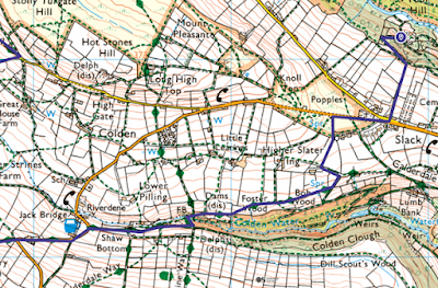
  • Checkpoint 2 re-connect to the Pennine Bridleway at Shaw Bottom
  • Diversion off the Pennine Bridleway, on the far side of Gorple Reservoir, to avoid a road section with no pavement. Reconnecting to the Pennine Bridleway at Gorple Gate Track. 

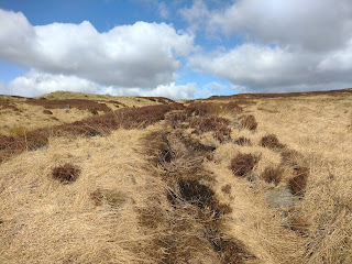
After several weeks of named storms, rough winds and heavy rain. Spring truly felt like it had arrived for this recce day, with bright blue skies and a crisp light breeze. Perfect walking weather and this itself would have made for a great day as we journeyed through the diverse Pennine Bridleway countryside. However, there were so many more treats that the trail had in store. Almost at every turn there were features not shown on the map, which sparked curiosity, amazement and delight.

My trail time was limited with car travel required to and from Hayfield as well as a taxi from Wycoller back to Hebden Bridge. That said, I covered 28km of the Pennine way in just under 7 hours, which included a leisurely picnic lunch and plenty of pauses for photos.


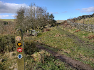
At no time did I find myself at all navigationally challenged. An occasional quick reference to the Harveys XT40 map was all that was needed. The course is well signposted, with plenty of new fixed finger posts in position and PBW discs on gateways too. 

Hence, the Pennine Bridleway Trail Challenge terrain is very much an accessible proposition for walk-jog participants, who can adopt a steady pace strategy and still have time for rest, refresh and food in the Checkpoints. As well enough runnable undulations to keep faster participants entertained and keep their momentum if choosing to aim for a 'time' or one of the trophy prizes.

Slack to Shaw Bottom 


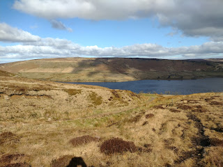
Gorple Lower Reservoir


Gorple Lower Reservoir - Compulsory safety diversion avoiding road with no pavement.


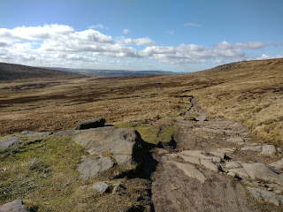
Dicken Rocks

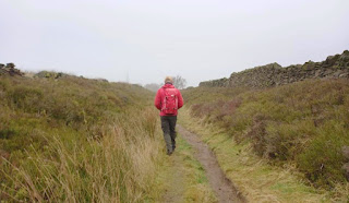
follow the trod up hill, northward, a small stream on your left side

Clough Head overlooking Widdop Reservoir

Reconnect to Pennine Bridleway

Gorple Gate Track


Pennine Bridleway North at Ben Edge (DO NOT continue on the Mary Townley Loop!)

Ben Edge to Dovestones Moor


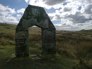
C17th stone doorway arch, remains of a farm built by Robert Parker. In 1886 the house was abandoned and demolished at the same time as the Coldwell reservoirs were being built.
Inscription on the door lintel:
OTHOV OF MIGHTY MOST SETHEM THAT MADE COSTY RP 1672
Refers to the construction date of the farm.
There is also an inscription with the names of Robert Parker, his wife and son Robert Henry.    


All farm buildings and private structures are out-of-bounds to race participants


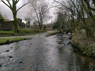
The delightful hamlet of Wycoller
Toilets available at the visitor centre


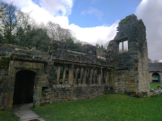
Wycoller Hall ruin. Said to be have been the inspiration for Ferndean Manor in Charlotte Bronte's Jayne Eyre.

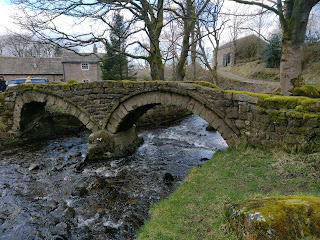
15th Century Pack Horse Bridge


Pennine Bridleway XT40 Map
The Harvey's 1:40,000 scale XT40 map is the most cost effective and portable mapping option available (all PB270 participants must carry a hard copy map, irrespective of whether their primary navigation tool is GPS). It is also waterproof and will hold up to a few day's trail running abuse, although it's not indestructible!

The screen shots below are from my Ordnance Survey subscription, which at 1:25,000 scale give better definition. 

However, AtoZ Adventure Series also have their own Pennine Bridleway 'strip map' format planned for publication. The 1:25k scale is easier to discern detail for folks who's eyesight isn't the best.

Enter the 2022 Ranger Ultras' Pennine Bridleway Trail Challenge


Trail Conduct:
Whether on a recce or during the race itself, please remember that you're representing the trail running community as a whole as well as a Ranger Ultras' participant. Please don't let being in the 'trail bubble' make you forget the following considerations:
  • Follow the Countryside Code
  • Be courteous to other trail & footpath users
  • Shut gates after you unless they're tied open
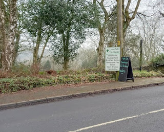
  • Please treat cafes, other establishments and their customers with respect
  • If you're a bit disheveled or muddy, ask permission to enter / sit down
  • Don't litter
  • If you need the toilet, use public conveniences where at all possible
  • Don't pee or poop in residential areas, beside properties or farm building.
  • Go well away from buildings and water courses, bury it or carry it out in a bag
  • Move swiftly through and past private residential areas 
  • Don't shine headtorches into residences or farm building
  • Farm buildings are private and should be treated as out of bounds
  • Farm building and public toilets are not appropriate bivvy locations


Wednesday, 26 January 2022

#061 Glossop Recce - Ranger Ultras - Pennine Bridleway 270km Trail Challenge


PB270 Trail Recces
This week, Peter, Rob and I headed out to make some detailed course notes for the Ranger Ultras' Pennine Bridleway 270km Trail Challenge. Our Ranger Ultras' trail races have already covered long sections of the Pennine Bridleway, so in this blog and subsequent reports we'll focus on other areas of the course.

Our notes will focus on aspects of the route which have made an impression upon us as well as tips which participants which may find useful.

  • Navigational notes and identifying red herrings
  • Trail conditions
  • On route facilities such as cafes, shops, food take away and public toilets

Pennine Bridleway XT40 Map
The Harvey's 1:40,000 scale XT40 map is the most cost effective and portable mapping option available (all PB270 participants must carry a hard copy map, irrespective of whether their primary navigation tool is GPS). It is also waterproof and will hold up to a few day's trail running abuse, although it's not indestructible!

The screen shots below are from my Ordnance Survey subscription, which at 1:25,000 scale give better definition. 

However, AtoZ Adventure Series also have their own Pennine Bridleway 'strip map' format planned for publication. The 1:25k scale is easier to discern detail for folks who's eyesight isn't the best.

Trail Conduct:
Whether on a recce or during the race itself, please remember that you're representing the trail running community as a whole as well as a Ranger Ultras' participant. Please don't let being in the 'trail bubble' make you forget the following considerations:
  • Follow the Countryside Code
  • Be courteous to other trail & footpath users
  • Shut gates after you unless they're tied open
  • Please treat cafes, other establishments and their customers with respect
  • If you're a bit disheveled or muddy, ask permission to enter / sit down
  • Don't litter
  • If you need the toilet, use public conveniences where at all possible
  • Don't pee or poop in residential areas, beside properties or farm building.
  • Go well away from buildings and water courses, bury it or carry it out in a bag
  • Move swiftly through and past private residential areas 
  • Don't shine headtorches into residences or farm building
  • Farm buildings are private and should be treated as out of bounds
  • Farm building and public toilets are not appropriate bivvy locations
The Recce Around Glossop
Out of all the 270km, the routing around Glossop is the most complex. But, it is far from difficult if a 'heads up' navigation style is adopted to spot the way ahead. The sections we focus upon here are mostly the Pennine Bridleway Alternative Walkers Route. 

Keep an eye out for the white discs with black text & symbols on styles and finger posts. Through this particular area we've chosen to use this route, rather than the main Pennine Bridleway, to as much as possible avoid participants walking along narrow country lanes with no pavement. 

Rest assured there's plenty of countryside to enjoy as well as some impressive bridges and historic buildings dating from the industrial revolution. Further north, the route travels through the dark peat moors along drovers trails, past grand reservoirs and into the Yorkshire Dales. Combined with the white Peak District (from the start to Checkpoint 1), the icons of the Pennine Bridleway are a feast for the senses.

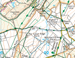
1) Leave Pennine Bridleway and join Cown Edge Way
(PB alt. walkers route)
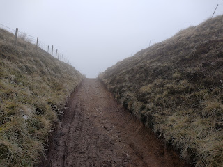
Tarmac. Consolidated stone trail. Sunken trail. Grassy moorland, good trail, not boggy


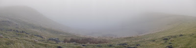
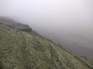
Unfortunately the day was claggy, but it's January so we took what the weather gave us. 
Which did flatten the colours and depth in the pictures, but took away none of the atmosphere and pleasure of being on the trail.

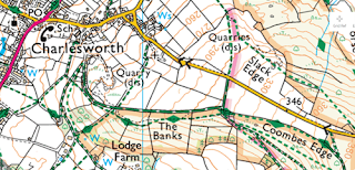
2) Coombes Edge to Charlesworth
Following Cown Edge Way (PB alt. walkers route) - tip: use fences and boundary walls to avoid drifting off route


Then leave PB alt. walkers route and continue on sunken bridleway track to Charlesworth
Cross A626 at Charlesworth (Care!)
Rejoining PB alt. walkers route, continue down Long Lane (use pavement)

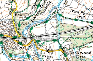
3) Bankwood Gate, 
Following Trans Pennine Trail (PB alt. walkers route)
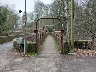
Cross river over footbridge beside road
Uphill on pavement 
Lymefield Garden Centre Tea Room (outside seating) open Mon-Sat 09:30 to 17:00
China Town Chinese Take Away open Wed & Thurs 16:30 to 22:30
Under railway bridge
Turn right onto Hague Road track.


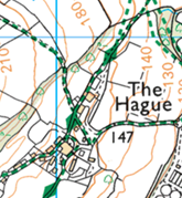
4) Route past through farms at The Hague
Following Thameside Trail (PB alt. walkers route) 


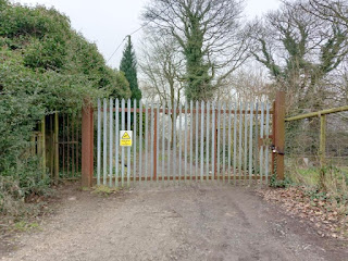
Through the intial area of farmhouses, up to gate with CCTV sign on.
There is a narrow 'kissing gate' on the left side.


Keep looking for the black and white PB alt. walkers route disks.


Red herring - our route is not over the style.
Pass through the narrow stone pillars on the left side of the iron gate.
This is a public right of way.
Past riding menage and emerging into fields.

5) Padlocked gate preventing access through Tara Brook Farm stableyard
Route around - At padlocked gate, turn right follow hedge to track (shown as black parallel lines on map). Use metal farm gate, there's a unusual sliding metal latch. Please close gate. Turn left on a short section of track to rejoin Thameside Trail on far side of the stableyard and use the driveway (public right of way) to main road. 
Cross A57 (care!) 
Directly opposite, following Thameside Trail (PB alt. walkers route)


6) At Hollingworth, cross A628 (Care! Use Pedestrian Crossing)
Cosy Cafe open Wed & Thurs 09:00 to 15:00,
One Stop & Brightmores food stores within 100m of the crossing
Green Lane
Public Footpath finger post and PB alt. walkers route disk
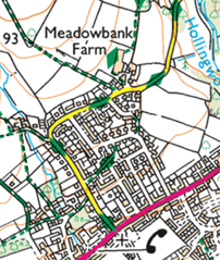
Around Meadowbank Farm and continue north
Following Thameside Trail (PB alt. walkers route)