PB270 Trail Recces
This week, Peter, Rob and I headed out to make some detailed course notes for the Ranger Ultras' Pennine Bridleway 270km Trail Challenge. Our Ranger Ultras' trail races have already covered long sections of the Pennine Bridleway, so in this blog and subsequent reports we'll focus on other areas of the course.
Our notes will focus on aspects of the route which have made an impression upon us as well as tips which participants which may find useful.
- Navigational notes and identifying red herrings
- Trail conditions
- On route facilities such as cafes, shops, food take away and public toilets
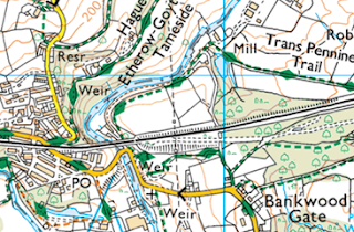
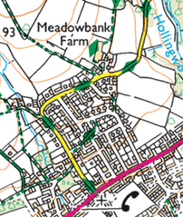
The screen shots below are from my Ordnance Survey subscription, which at 1:25,000 scale give better definition.
Whether on a recce or during the race itself, please remember that you're representing the trail running community as a whole as well as a Ranger Ultras' participant. Please don't let being in the 'trail bubble' make you forget the following considerations:
- Follow the Countryside Code
- Be courteous to other trail & footpath users
- Shut gates after you unless they're tied open
- Please treat cafes, other establishments and their customers with respect
- If you're a bit disheveled or muddy, ask permission to enter / sit down
- Don't litter
- If you need the toilet, use public conveniences where at all possible
- Don't pee or poop in residential areas, beside properties or farm building.
- Go well away from buildings and water courses, bury it or carry it out in a bag
- Move swiftly through and past private residential areas
- Don't shine headtorches into residences or farm building
- Farm buildings are private and should be treated as out of bounds
- Farm building and public toilets are not appropriate bivvy locations
Out of all the 270km, the routing around Glossop is the most complex. But, it is far from difficult if a 'heads up' navigation style is adopted to spot the way ahead. The sections we focus upon here are mostly the Pennine Bridleway Alternative Walkers Route.
Which did flatten the colours and depth in the pictures, but took away none of the atmosphere and pleasure of being on the trail.
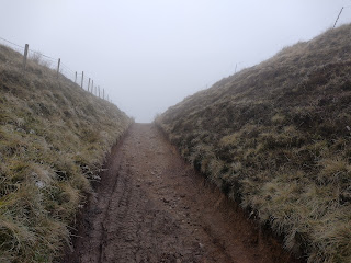
Following Cown Edge Way (PB alt. walkers route) - tip: use fences and boundary walls to avoid drifting off route
Rejoining PB alt. walkers route, continue down Long Lane (use pavement)
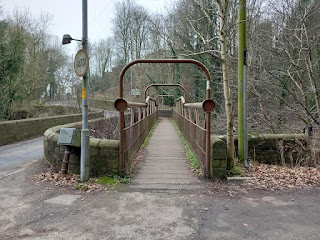
Following Trans Pennine Trail (PB alt. walkers route)
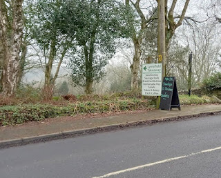
Uphill on pavement
Lymefield Garden Centre Tea Room (outside seating) open Mon-Sat 09:30 to 17:00
Turn right onto Hague Road track.
There is a narrow 'kissing gate' on the left side.
Pass through the narrow stone pillars on the left side of the iron gate.
This is a public right of way.
Route around - At padlocked gate, turn right follow hedge to track (shown as black parallel lines on map). Use metal farm gate, there's a unusual sliding metal latch. Please close gate. Turn left on a short section of track to rejoin Thameside Trail on far side of the stableyard and use the driveway (public right of way) to main road.
Cross A57 (care!)
Directly opposite, following Thameside Trail (PB alt. walkers route)
One Stop & Brightmores food stores within 100m of the crossing
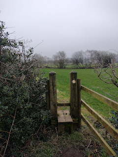
Public Footpath finger post and PB alt. walkers route disk
Around Meadowbank Farm and continue north
Following Thameside Trail (PB alt. walkers route)









No comments:
Post a Comment