

Evidence of human activity on the Isle of Arran dates back to the Mesolithic (middle stone age). These people were hunter gatherers who would have taken advantage of the heavily wooded lowland areas for fuel, shelter materials and fruits of the forest. On an island where the sea is never far away, the foreshore offers abundant foraging opportunities. Fresh water rivers and streams consistently flow from the central mountains, lochs and lochans. Roaming in the forest and uplands, red deer were a ready source of protein which could feed a whole extended family.
 |
| Credit: Kim Biddulph - Prehistory blog |
Before we get too much further into dates and detail, it's worth at this point adding a timeline encompassing the Mesolithic, to Neolithic, to the metal ages, in ancient Britain. I emphasise our British geographic locality, as the dates of the Neolithic and bronze age transitions vary. These new ideas and cultures did not arise everywhere spontaneously, they spread through migration. Both in people's minds and portable trading goods. So, for example, the Chalcolithic (pre-Bronze copper period) was present in Europe around 5000BC, but would not arrive in Britain until 2400BC in the form of daggers and axes.
 |
| View to the west from Machrie Moor |
Hunter gatherers are typically mobile, moving between temporary or seasonal camps. This has the advantage of following game migrations, sources of edible plants and fruiting berries. Relocation tends to avoid overexploitation of resources and periodically refreshing dwelling structure materials reduces the insect burden.
 |
| Standing stone, with possible cist at rear |
The Machrie is surrounded by an arc of high ground and fed by freshwater, which drains into the sea on Arran's west coast. It is somewhat of a stretch to call it a natural amphitheater, but on first impression its geography did remind me of Lochbuie on the Isle Of Mull, which has all these features in common. Like Lochbuie, there are also caves. Nearby to Machirie is Kings Cave which no doubt was a feature of Mesolithic life.
However, a 1909 archeological dig found little of note except, an obviously much later, small bronze ornament and a few animal bones. Given that archaeological practice and methods have moved on considerably since the 1900's I wonder what subtle evidence of the Mesolithic might have been there, that is now lost.
Around 3500BC the Neolithic, new stone age, arrived in Arran. The spread of farming ideas, methods and culture from the middle-East, through Iberia and Gaul then into Britain was not simply a uniform radiation, like ripples on a pond. It vectored along corridors. Based on dating and typography of both portable and monumental evidence, Professor Alison Sheridan, proposes that there were four phases to the Neolithic 'revolution' in Britain:

1) First early, but unsuccessful, migration from Brittany to Ferriter's Cove in Ireland
2) Second, more successful, from Brittany up the Atlantic facade of Britain and Ireland in 4300 and 4000BC
3) The 'Carinated Bowl Neolithic' from the near continent, between 4100 and 3800BC
4) The Trans Manche Ouest strand from around 3800BC from Normandy, to The Channel Islands, The Bristol Channel and the south coast.
Current evidence suggest that it was people arriving with Carinated Bowl Neolithic culture which displaced or outcompeted the Arran hunter gatherers.
 |
| Machrie Moor 11 - on site of previous timber circle |
Around 4500 years ago timber circles were erected on Machrie moor. This type of structure is contemporary with other locations in Britain, such as Wood Henge on Salisbury Plain. However, eight excavated post holes on the site of the current Stonehenge car park have been dated to 8000BC; firmly within this Mesolithic period. A possible indicator of ritualised behaviour involving astronomical interpretation being practiced before the arrival of Neolithic farmers.
 |
| Machrie Moor 1 - on site of previous timber circle |
Even using only a rudimentary phenomenology approach to the Machrie moor environment, it feels like a special place. It is the locus of natural features, mountains, rivers and sea. More than just a collection of the practical and useful, Machrie has an aesthetic quality that invites the visitor to stay. Perhaps our stone age ancestors, in deciding where to settle, felt a similar connection.
 |
| Machrie Moor 4 |
Five hundred years after the wooden circles were created, two stone circles were created on the same sites. Probably around the same time, four other stone circles were erected, one with a double ring of stones - known through local folklore as Fingal's Cauldron Seat.
 |
| Fingal's Cauldron Seat |
The result was an impressive ceremonial centre for those that lived or travelled to Machrie Moor. Several of the stones appear to have been carefully chosen. Certainly the tall sandstone uprights bear a striking resemblance to the Orcadian Stones of Stenness in the way they have been cleaved from the bedrock. Burials within stone circles have been dated to within one or two generations after their creation.
 |
| Machrie Moor 2 |
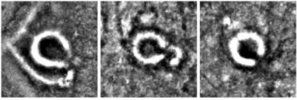
The Neolithic and later Bronze age farmers built their dwelling round houses (and there were many of them) in the Machrie moor area. Their locations are still subtly visible as slightly raised 'hut circles'. In 2018 the Norwegian Section For Earth Observation and Historic Environment Scotland published the results of a joint study of Machrie Mor using LiDAR (Light Detection And Ranging) imaging.
 |
| Machrie Moor LiDAR features: Roundhouses (cyan), small cairns (yellow) |
The LiDAR technique highlighted even more hut circles and a nearby Neolithic cursus feature which had not been previously identified due to later bronze and iron age dwelling structures being built on top.
 |
| Machrie Moor: LiDAR roundhouse detail |
I conducted my own desktop analysis using hut circles and other features on Ordnance Survey (subscription) mapping. I plotted these on a screen grab from Google Earth to show the distribution and abundance of these features:

Cyan = hut circles
Yellow = cairns, cists and burial features
Orange = standing stones and outliers
Red = stone circles
Blue lines = rivers and major streams
 |
| Machrie Moor 2 |
On the approach to Machrie Moor is a large kerb cairn, around 20 metres diameter. Sadly the condition is much deteriorated through repurposing of the stone for walling and dykes over the centuries. It was made from heavy boulders set in yellow sand, topped with distinctive small pieces of red sandstone. Circling the cairn was a 3 metre outer bank of fist sized stones, then a kerb of upright sandstone slabs.

The cairn has only been partially excavated, so it is not known what is at the centre. It may conceal a stone-lined cist, in which a body would have been placed in a crouched position with objects like pottery and tools.
 |
| Moss Farm Road cairn |
This type of kerb cairn with a single inhumation dates from around 2500BC. It represents a cultural change from the earlier communal Neolithic burials in chambered cairns and cremations buried within pottery vessels. This date coincides with the brief chalcolithic (copper age) and early bronze age.
 |
| Machrie Moor 3 |
The arrival of metal brought new and improved benefits and uses, from tools, to weapons and adornments. It stratified society, elevating those who held and controlled the knowledge above the rest of the population. These 'alchemists' may have displaced the power of the old shamans, as people looked to the new wonder of copper and bronze.
 |
| Machrie Moor 3 |
The people who brought these new ways were called the Beaker People, named after the distinctive bell-shaped pottery beakers found in the archaeological record. The 'bell beaker' style originated in the southern Iberian peninsular and first appeared in Britain around 2475-2315BC.
 |
| Machrie Moor 3 |
By 800BC a profound change in climate had a detrimental affect upon the quality of arable lowland. The moor transformed into peat and bog, forcing people to abandon their farms and move to higher ground. This coincided with the arrival of the Iron Age and another seismic change in culture.
Artefacts including Neolithic pottery and flint have been unearthed at Machrie Moor. However, with so many archaeological features only partially studied in detail, there may be other remains still buried in the peat.

Sources:
Machrie Moor On Site Information Boards - Historic Scotland
Invasion, colonisation or intimidation? Debating how and why Britain joined the 'Neolithic Club' - Current Archaeology May 2014 thepast.com
Using deep neural networks on airborne laser scanning data. Results of a case study of semi-automatic mapping of archeological topography on Arran, Scotland. - Trier, Cowley, Wadeland. pub Wiley 2018
Bronze Age Britain - warwick.ac.uk

Peak District 3 Peaks Challenge
Edale Skyline Challenge
Kinder Scout Sunrise Breakfast Experience
Kinder Scout Supermoon Special
Kinder Scout Winter Wonders
No comments:
Post a Comment